How to Hike the Cape Wrath Trail in Two Weeks

We completed this journey during the second half of May 2018. It was pretty spectacular, but also challenging, remote, and at times monotonous. Still, we think it's worth it for the challenge. And the bothies!
If you've decided to hike it, or are considering your own trip to Scotland, here's our itinerary to help you complete the journey in a fairly reasonable two weeks.
We also wrote our best tips for the trek in another article, here. It explains why we chose to hike it north to south, plus all the gritty details of the trip (including what we'd do differently).
Happy hill walking!
Our Itinerary
Note - all times and distances are estimates based on our actual experiences (ie, when we got lost). You can find the exact distances on Walk Highlands and the Harvey maps.
Day 1: Travel Day
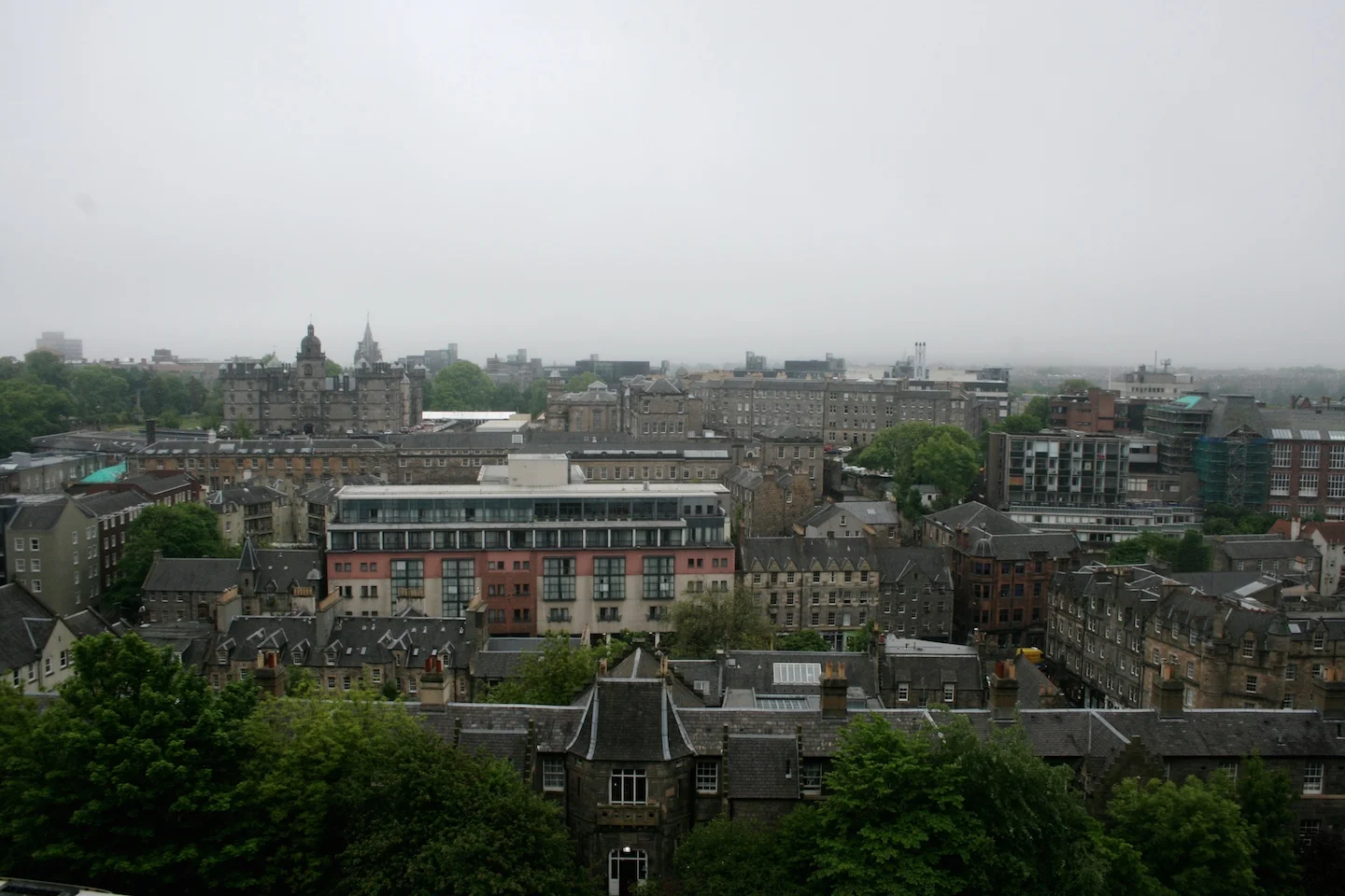
It took almost all day to get to Cape Wrath from Edinburgh. We took a train to Sterling, then another to Lairg. Caught the Durness bus there and waited on a very unreliable ferry. Check out detailed information in our post here. Instead of taking yet another bus all the way to Cape Wrath, we walked about 8km along a dirt road through MOD territory to Kearvaig bothy, which is an absolutely lovely place to start your journey and is located about 3km before the official start of the Cape Wrath Trail.
Day 2: Kearvaig Bothy - Sandwood Bay
The first day of this trek really let us know what we were in for. After a few easy kilometers along the road we reached the lighthouse at Cape Wrath and took the appropriate pictures. There's an overpriced cafe there, and likely some weathered hikers just finishing up their own journey. We then headed briefly back down the road and turned off into some proper bog. We stuck close to the ocean after being told it was less boggy there. Apparently it was, as we didn't get soaked, but it was hard walking, with lots of up and downs and absolutely no sign of any trail whatsoever. This day was very slow going, but also included a stop at Cape Wrath.
Sandwood Bay is probably the best beach on the trek. But it can get congested with day hikers (unlike anywhere else). Generally the north is more populated than the South so you'll see more through hikers there. You can camp on the beach or on a grassy knoll above it like we did.
Length: ~16km
Time: 7 hours
Difficulty: Boggy and no trail
SleepING: a lovely patch of grass overlooking sandwood bay
Day 3: Sandwood Bay - Stack Lodge
We started out the day wandering along the beach. It really is gorgeous, and there's a surprising amount of sand. Not what you picture when you think of Scotland. We then headed up and over some small hills toward the tiny town of Blairmore. The trail is EXTREMELY good here, the best of the whole trip, so soak it in.
Once in town, we decided to save some time and hitch hiked from Blairmore to Rinconich. We would highly recommend this, as much of the track is along the road - no fun at all to walk. Rinconich could barely be called a town, but it does have some public toilets and sinks that could be useful.
The next section of trail was quite pleasant, if boggy, following for a couple hours along the first real lochs of the trip. It then broke into open bog land (which wasn't too hard to navigate) before meeting up with a 4x4 track. This was a godsend - the end of the day was easy walking to Stack Lodge. Fortuitously, it was closed, so we could camp in their pristinely manicured lawn. If you're not so lucky, continue along the trail for another 20 minutes or so and you'll find a cute little beach by the next lake you reach. Definitely camp there - afterwards, the trail disintegrates into gnarly bog.
Length: ~30km (including a hitch)
Time: 8hrs
Difficulty: quite enjoyable, a bit o bog along the lake
SleepING: Camping at stack lodge
Day 4: Stack Lodge - Glencoul Bothy
The trail from Stack Lodge follows a proper road briefly and then turns up and up past some lovely lakes. It's a bit hard here to tell exactly when you should leave the 4x4 track, cross a few deer gates, and enter the bog. We spent an extra hour or so waffling about this. Then another hour making our way through trackless moorland up to the top of Ben Stack, which has fabulous views.
We made the rather bold decision, after walking down the other side of Ben Stack on a gravel road, to abandon the trail. Instead of heading to Kylestrom, we cut some corners and walked straight to the bothy at Glendhu. We can't guarantee this would be a good idea in all weather. But we can tell you it worked for us, and their were no cliffs in the way. Proceed at your own risk and try to glance at a topo first. Glendhu is beautifully situated and would make a great overnight stop.
Instead, we kept chugging and made it to Glencoul bothy. You have to go up another stack, in what is essentially a slowly running river, and back down to Glencoul bothy on the other side. It isn't so hard, and the trail offers great views.
Length: ~28km
Time: 11 hours
Difficulty: Navigation was hard, and a good amount of elevation change
SleepING: Glencoul bothy
Day 5: Glencoul Bothy - School House Bothy
The area after Glencoul bothy was mostly pathless, but gorgeous. It climbed up and up past numerous small lochs to reach Bealach na h-Uidhe. Then, down again on a whole lotta bog. Today was the first day that we started to have joint issues. In this case, the ankles.
After walking the final stretch into Inchnadamph on a gravel road, we decided to hitch the next section (all the way to Oykel Bridge) to save both time and ourselves. It took us about 5 minutes, 2 minutes longer than it had in Rinconich.
The walk to the School House bothy is very easy from Oykel, and highly recommended. It's all old fire road, and pretty flat. Plus, you have a bothy at the end, which makes it all worth it.
Length: ~58km (including hitch hike)
Time: 11 Hours
Difficulty: Pathless, with some steep climbs, but not overly boggy
SleepING: Schoolhouse bothy
Day 6: School House Bothy - Inverlael
We got hopelessly lost after leaving the Schoolhouse. It was our own fault - the fire roads were simply too easy walking. But, be warned, it can happen.
After finally finding our way, the first half of the walk was quite easy. Then, we entered the lovely Glen Douchary. We were told this was the best part of the trek. It was quite pretty - some of the greenest area you'll see in Scotland. We know, surprising. The country isn't as green as you think. Still, this section is a bit tricky technically. It can be hard to find the little path there is, and if you take a wrong turn, you could end up at the bottom of a cliff and have to turn around (like we did).
After the glen, the last section of the track is on a 4x4 road. We camped next to the river, right before Inverlael. It was the first night of rain for us, but it was still cozy in the tent.
Length: ~26km
Time: 11 hours
Difficulty: hard navigating, but nice 4x4 road on either end
SleepING: along the river before inverlael
Day 7: Inverlael - Shenavall
This was the only day it rained on our entire trek. And goddamn it poured. After leaving camp, we wandered through Inverlael, where a few hikers were catching the bus to Ullapool for food. We climbed past some sheep farms and walked a clear path through pretty, if high, terrain. It would have been a lovely walk if not for the sideways rain. At the very end of the day, right before the trail descended to the bothy where we would stay the night, it turned into an absolute waterfall.
Speaking of the bothy - Shenavall was our favorite bothy of the entire trip. If you get the chance, do stay there. Its warm fire and friendly Scots saved us from what would have otherwise been a miserable night.
Length: ~21km
Time: 9.5 hours
Difficulty: Pretty Easy, if no rain
SleepING: Shenavall bothy
Day 8: Shenavall - Kinlochewe
After the bothy, the path is clear, or at least easy, past some big lochs. There are a couple ways to go, but we chose the 4x4 track down to a proper road. This meant that we were walking for an hour or so at the end of the day along quite a boring section. But, it was worth it for an easy day.
We camped smack dab in the middle of Kinlochewe. No one seemed to care, and it meant that we had a toilet and running water at our disposal. Such luxury. Plus there's a little store in town. It courteously takes just an arm as payment, rather than both an arm and a leg.
Length: ~28km
Time: 8 hours
Difficulty: straightforward, most of it on a 4x4
SleepING: public park in kinlochewe
Day 9: Kinlochewe - Maol Bhuide
We started off the day by hitch hiking to Craig. It was very easy, starting at the bridge in Kinlochewe; we snagged two quick rides from there. In Craig, we crossed the railroad tracks, and walked up a lovely gravel path. Near the top, there was a fun wire bridge crossing that offered many opportunities for pictures.
A very boggy downhill section took most of our time. It seemed like the end when we finally reached a 4x4 and indeed we did pass Bendronaig Lodge. We would highly recommend pushing on to Maol Bhuide, though. It's passed a fucking brutal moorland, though. It was a bit torturous, being able to see the bothy from miles away. It still took a couple hours to get there. We could see the tracks of an impressive machine that we later learned had made the journey earlier that day. And boy were we jealous.
Length: ~41km (including hitch)
Time: 12.5 hours
Difficulty: Mixed section of 4x4 and hard moorland
SleepING: Maol Bhuide
Day 10: Maol Bhuide - Morvich
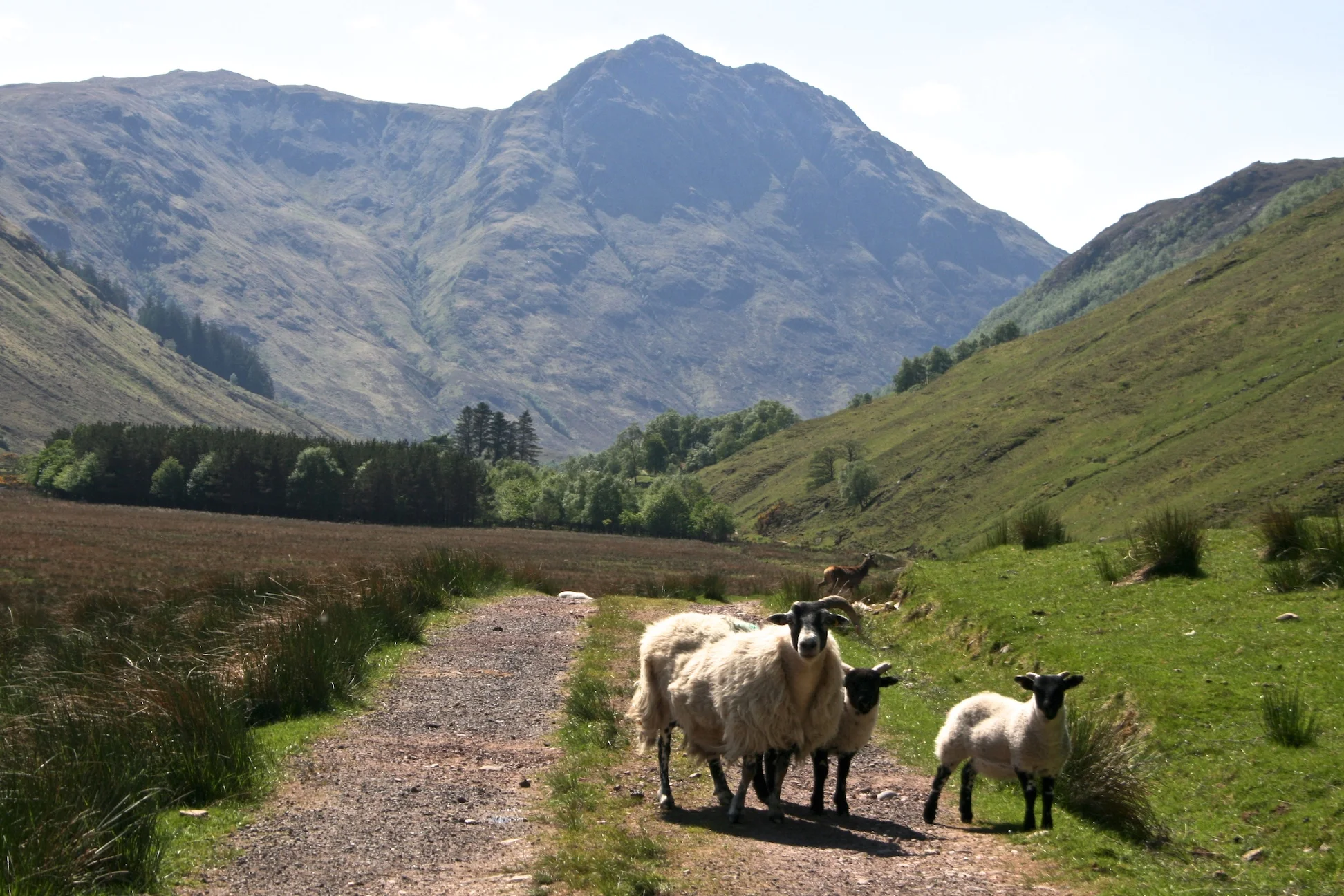
The trail follows a good path downhill past Maol Bhuide. Surprisingly, this is where Tori's knees began to go, which boded poorly for the rest of the hike. The bottom of the valley is a great place for a picnic. There are grassy banks next to the lochs and the sheep are cute and curious.
Next, it climbs up next to the Falls of Glomach. This is a gorgeous section. Stefan also managed to lose his one and only shirt at the bottom, so he got to hike it once and run it a second time. The trail then drops gently, through a forest, down to Morvich. There's plenty of accommodation in town. We camped next to a lovely rope swing and fire pit, a good four kilometers before it.
Length: ~23km
Time: 10 hours
Difficulty: Steep section next to the Falls of Glomach, but overall good path
SleepING: Camping in the Forest before Morvich
Day 11: Morvich - kinloch huorn
We left our little campsite and walked for an annoyingly long time through the town of Morvich. This is where we made the biggest decision on the Cape Wrath Trail. We chose to take the western route instead of the easier Great Glen variant. We're glad we did, even though we couldn't quite finish the whole thing in our time allowed. The views - and bothies - were still much better.
Finally, we passed Shiel Bridge, where there's a perfect river to swim in, and began climbing. Then path turns mildly nonexistent and boggy before reaching a good gravel road. Unfortunately, by this point, Tori's knees were totally wrecked. The last bit was very, very steep and quite slow going for us. We camped on a green piece of lawn in front of an abandoned building and got a bit of flac from the owner. There's a bit of flat ground after the gate, but it's not ideal. If you're not too tired, head to Barrisdale bothy.
Length: ~24km
Time: 11 hours
Difficulty: A good amount of bog, and a steep downhill
SleepING: camping at kinloch huorn
Day 12: kinloch huorn - Sourlies Bothy
We left early, and traversed a pleasantly undulating trail along the loch. It took surprisingly long to reach Barrisdale, so we stopped there for lunch.
Next was a gradual uphill followed by a fucking brutal downhill, with little path and lots of bog. This really did it for Tori's (by this point) weak joints and it took us ages to reach the bothy at Sourlies. The bridge is technically out at the river before the bothy. We had no trouble crossing, although the water level was low.
Length: ~23km
Time: 14 hours
Difficulty: Quite hard and long, with a steep downhill
SleepING: Sourlies bothy
Day 13: Sourlies Bothy - Fort William
We made a bold choice at this point in the trail. Because of Tori's bum knee, we decided to turn off the official route and hike out to Inverie. The trail was gentle, and we saw a fair few day hikers. There, we were able to catch a ferry to Mallaig and hitch back to Fort William. We met our ride on the ferry, so it was quite easy and enjoyable.
The alternative would have been to hike a longer day to Glenfinnan, finishing the following day with a short walk and final hitch or ferry to Fort Williams. We just weren't up for the long day(s). On the plus side, Inverie was beautiful and the ferry offered views toward the Isle of Skye. Camping in Fort William was somewhat sketchy, so we'd recommend moving on if you can.
Length: ~96km
Time: 8 hours
Difficulty: easy
SleepING: A park along the loch where camping wasn't strictly allowed
Day 14: Travel Day
We made it back to Edinburgh that last day, on the bus, with a quick transfer through Glasgow. There weren't any trains that day, because it was a bank holiday. It probably wouldn't have been any cheaper anyway, since we booked the busses in advance. Hitch hiking may have been possible, but the roads got quite large a few hours south of Fort William.
With a very painful knee and an altered itinerary, it didn't really feel like the end of a mighty trek. But it was a good ride. The Cape Wrath Trail is challenging and frustrating, mostly because the "Cape Wrath Trail" is something that someone (probably on the internet) made up. There are a million different variations, directions, and ideas when it comes to this route. But if you put some effort forward, you'll see some pretty spectacular scenery and get a damn good taste of the Scottish highlands.
Got any more questions? Your own thoughts about the Cape Wrath Trail? Let us know below.